
Ground Hazards
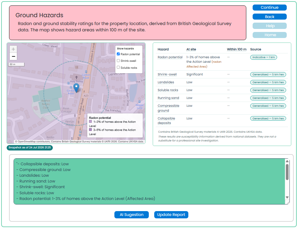
This screen summarises ground-related hazards for the property location using British Geological Survey data. It helps you identify conditions that may affect the site or require further investigation.
Purpose of this screen
The Ground Hazards screen provides a location-based overview of potential ground conditions within and around the subject property, including:
- Radon potential
- Shrink–swell clay
- Landslide susceptibility
- Soluble rocks
- Running sand
- Compressible ground
- Collapsible deposits
The map shows the property location and the surrounding 100 metre area. The hazard table explains the applicable rating for each category and identifies whether the information relates directly to the site or to a wider generalised area.
How to use this screen
- Review the property marker on the map and the 100 metre search area.
- Use the hazard controls to show or hide available map layers.
- Check the hazard table for the site rating, nearby findings, and data source.
- Review the suggested report wording in the text box below the map.
- Edit the wording where necessary to reflect your professional judgement.
- Select AI Suggestion if you would like help drafting suitable report commentary.
- Select Update Report to save the approved wording to the report.
Understanding the results
Hazard ratings indicate the potential for a ground condition to be present in the area. A low or significant rating is not, by itself, confirmation that a problem exists at the property.
Some results are based on indicative data for the immediate area, while others are derived from wider generalised mapping. Always consider the age, construction, visible condition and site setting of the property alongside these results.
Radon potential
The radon result indicates the estimated proportion of homes in the area that may be above the Action Level. Where the result identifies a potential risk, consider whether radon protective measures, testing or further advice may be appropriate.
Important distinction
This screen can add commentary to the report. The map and hazard data support the assessment, but the final wording remains your responsibility and should be reviewed before updating the report.
The information is susceptibility data derived from national datasets. It is not a substitute for a site investigation, geotechnical assessment, environmental survey or other specialist advice.
Why this matters
Ground conditions can affect building performance, maintenance requirements, drainage, foundations and future development. Reviewing these risks early helps ensure that relevant observations, limitations and recommendations are recorded in the desktop research report.